Franz Creek Bridge Replacement
Transportation and Public Works is now Sonoma Public Infrastructure - Website updates coming soon!
General Information
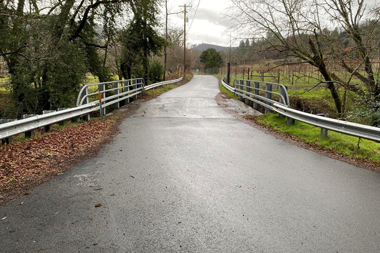
Location: Franz Valley School Rd (Lat/Lon: 38.583731, -122.671856)
Sonoma County is currently working towards replacing the single-lane bridge over Franz Creek, on Franz Valley School Road. The bridge requires replacement due to scour deficiencies. Age and erosion from the stream are threatening the structural integrity of the existing bridge.
The proposed new bridge will be a single span (no piers in the stream), cast-in-place reinforced concrete box girder bridge, consisting of two 10 ft lanes, one 3 ft shoulder and one 11 ft shoulder. The new bridge will be constructed upstream (south) of the existing bridge on a new alignment. The existing bridge will remain open to traffic during construction and will be removed after the new bridge is opened to traffic. Construction is anticipated to be performed over a single season. The project is currently in the environmental process with various studies ongoing. Planned National Environmental Protection Act (NEPA) clearance date is fall 2022.

Figure 1: Proposed alignment as of Fall 2021
Frequently Asked Questions
1. Why is the bridge being replaced?
Regular inspections have determined that the bridge is reaching the end of its service life. Age and erosion from the stream are threatening the structural integrity of the bridge, prompting Sonoma County’s Department of Transportation and Public Works to act.
The most recent Caltrans inspection (October 2020) gave the bridge a sufficiency rating of 35.7/100. Any bridge with a sufficiency rating less than 50 is a candidate for replacement. The most recent hydraulics report (8/28/2013) determined that the bridge is scour critical, meaning the structure is at an increased risk of failure during a large storm event.
2. Is the existing bridge safe?
Yes, based on what is known, the current bridge is safe. The bridge is inspected by Caltrans every two years. The County is monitoring the status of the bridge as well. If deemed to be unsafe, the bridge would be closed and alternatives would be explored.
3. Why replacement and not rehabilitation?
Due to the nature of the foundation erosion, rehabilitation was determined to be infeasible and cost-prohibitive. The engineering and construction difficulty of foundation repair, and the environmental impacts of the extensive in-stream work that would be needed for that work, prompted the County to seek other options.
4. Can the bridge be replaced on the same or similar alignment?
The proposed new alignment was generated to mimic the existing alignment, while meeting current design and safety standards, optimizing value, minimizing environmental impact, and considering other community feedback.
- The existing bridge alignment does not meet current engineering safety standards for width, design speed, sight distance, barrier railing etc. The same alignment is not feasible and would not be safe by today’s standard.
- The replacement bridge is required to meet County, State, and Federal engineering standards. Bridge standards require at least two full lanes with shoulders, and geometry and visibility requirements also need to be met. All these items result in a wider bridge compared to what exists today.
- To protect the new bridge from future erosion, to reduce environmental impacts, and to minimize the potential to cause flooding, the bridge is required to be longer and higher than the existing bridge. The longer span provides for unconstrained flows and will eliminate erosion at the abutments.
5. Can the County replace the bridge on an alignment to the north of existing bridge?
The engineering team evaluated a more northerly alignment and concluded a northerly alignment was imprudent and ran counter to requests and priorities indicated by the surrounding community. The northern alignments straightened the bridge approaches, which oftentimes results in increased traffic speeds. A northerly approach also would have significantly increased costs and environmental impacts.
6. Can the County reduce the design speed?
The average approach speed to the bridge is 39 mph. The County had to obtain special approval from Caltrans to reduce design speed to 25 mph (lowest allowed). The proposed 25 mph alignment was revised to mimic the pronounced reverse curvature of the existing alignment, introducing traffic calming to the proposed alignment.
7. Can the County reduce the amount of right of way required?
The County continues to endeavor to reduce the need for right of way acquisitions. The current proposed alignment (green, see Figure 1) significantly reduced the necessary additional right‐of‐way acquisition compared to that needed for the alignments shown during the Oct. 2018 meeting (Red and Blue, see Figure 1).
The County has revised the project as best we can in an effort to incorporate the many public requests, including a goal to reduce the need for right of way acquisitions. But considering project constraints and other community feedback we are unable to accommodate all requests, some of which would result in a project that would not meet safety standards and modern design requirements. We believe we have developed the best reasonable alternative that meets all mandatory project requirements while also best accommodating the goals and concerns of the majority of the community.
- The blue and red alignments were the previously presented alignments which the Franz Valley community strongly discouraged (see Figure 1). The new alignment (green), took into consideration comments received at the previous meeting and subsequent communications. From a right of way perspective, the green alignment is the most similar to the current roadway, and requires the least amount of right of way overall.
- The County is required to negotiate in good faith with all land owners and provide compensation at fair market value.

Figure 2: Three alignments presented to the Franz Community March 11, 2021
Should additional opportunities or changed circumstances arise, the County will continue to explore ways to further minimize the right of way required for the project moving forward.
8. Will the proposed bridge decrease visibility or safety?
The proposed alignment will meet current visibility standards and will improve overall visibility compared to existing conditions. Furthermore, the project is required to adhere to all State and Federal engineering safety standards.
9. Can the County reduce the number of trees to be removed?
The County is minimizing the number of trees to be removed, although some will still require removal. The current proposal removes the least number of trees compared to previous alignment designs. The County will plant trees to mitigate for those removed as required by the environmental permits.
10. Are any retaining walls proposed?
Roadway approaches were redesigned to eliminate the need for retaining walls in favor of graded embankments. There is a short section of wingwall leading up to the bridge on the western approach.
11. What will the dimensions of the new bridge be?
The existing bridge is one lane and is approximately 14’ wide. The new bridge will be approximately 80’ long and 39’ wide (comprised of two 10' lanes of traffic, one 12' shoulder and one 3’ shoulder). The extra wide (12’) shoulder is due to the curved nature of the bridge and the need under current design and safety standards to provide adequate stopping sight distance through the curve.
12. How is this project funded?
The project is funded through the Federal Highway Bridge Program (HBP). The HBP process is managed by Caltrans through the Local Assistance program. The preliminary estimate for this project is $7,000,000.
13. Is there any artificial lighting proposed?
No. Permanent lighting is not proposed.
14. Can the County Promote Natural/Rural Appearance/Aesthetics/Minimize Visual Impacts?
The County will promote the existing character of the roadway where possible.
- Architectural features and natural colors for the bridge and barrier rails will be introduced further along in the design phase. The County is actively engaging with Franz Valley community members regarding different aesthetic options.
- The new alignment mimics the existing alignment to the maximum extent feasible while meeting current safety standards. The back to back curves and the elimination of the retaining wall maintain the rural nature of the roadway.
- Bridge length has been reduced by 60+ ft compared to previous proposals and will have a significantly smaller footprint and visual impact.
15. Bike and Ped Safety during Construction
The existing bridge will remain open during construction, allowing bikes and pedestrians to bypass the majority of the construction area.
16. Noise/Construction Impacts
Impacts will be temporary and the County plans to limit work to one construction season. Impacts and mitigation measures will be evaluated during environmental review.
Project Goals, Status and Timeline
Project Goals:
- Replace existing bridge with a bridge that meets modern design and construction standards
- Design a bridge that reflects local character and environment
- Improve safety and access for drivers, pedestrians, cyclists, and emergency services
Project Status:
The project is currently in the National Environmental Protection Act (NEPA) environmental process, with various technical studies ongoing. Anticipated NEPA clearance date is fall 2022.
Estimated Target Dates (subject to change):
- NEPA Clearance fall 2024
- CEQA Clearance 2025
- Environmental Review Committee 2025
- Board of Supervisors approval 2025
- Permitting 2025
- Right of Way acquisition 2025
- Construction 2026
Contact Information
Please direct any questions to Chet Jamgochian at chet.jamgochian@sonoma-county.org.