 Translate
Visual Assessment Guidelines
The purpose of this administrative procedure is to provide guidelines for the assessment of visual impacts in the preparation of Initial Studies and Environmental Impact Reports.
January 2019
General
These guidelines provide procedures to guide staff and consultant’s in preparing and analyzing visual impacts. While the analysis of visual impacts involves qualitative judgements, this procedure is intended to define a methodology that utilizes to the extent practicable, objective standards that can be described and utilized in a consistent manner.
Procedure
To analyze the visual effects of a specific project the following procedures should be followed:
Determine Viewpoints and Characterize Environmental Setting
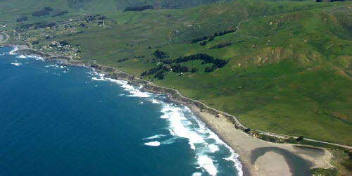
Project impacts will be analyzed by considering public viewing points. Public viewing points include public roads, public trails, and public parks. Other public gathering places may be considered on a case-by-case basis. Start with topographic maps and aerial photos. Follow up with a “windshield” survey of roads in the vicinity of the project to determine where the project would be most visible to the general public. Consider a variety of viewpoints, and not only the point at which the project is most visible. The “baseline” environmental setting of viewpoints should be discussed in terms of existing physical features, as well as applicable regulations pertaining to development and scenic resources.Prepare Photos to Illustrate Visual Impacts
Photographic analysis is required to evaluate potential visual impacts. Architectural renderings can be used for design considerations, but are discouraged in visual impact analysis because they tend to soften the effects. The visual impact analysis focuses on the mass, scale and contrast of the structure in relation to its surrounding.- For smaller projects, or projects located within or near urban service areas, staff shall coordinate with the applicant to construct story poles, or tethered balloon clusters that accurately represent the height and location of the project. The story poles or balloon tethers should be marked with bright red, orange or similar color at 5-foot intervals to provide a reference scale on the photos. In some instances a notice to the area residents describing the purpose for the story poles should be provided and/or site visit should be arranged for the decision-making body.
Take photos of the site from the various viewpoints identified in Step 1, or require the applicant’s representative or consultant to provide photos taken from the selected viewpoints along with a site plan illustrating the location and height of each story pole and the viewpoints for the photos. If telephoto photos are to be taken, be sure that a similar photo is taken that represents the view seen by the human eye. A 360 degree panoramic view, taken from where the project will be located, is helpful to convey the surrounding landscape.
The photos should be marked by outlining the proposed structure using the story poles or balloons as a guide for the roof line and corners of the structure. In some instances, offsite views may be at such a distance, that the balloons or story poles are not readily apparent in the photos without the use of a telephoto lens – include both telephoto and normal eye view in these instances may be needed to illustrate the structure. - For more larger or complex projects, or projects located within a scenic resource area, a digitized photo simulation may be required. Prior to the preparation of a photo simulation, staff should review and determine the number and location of viewpoints required. Simulations should illustrate the project upon completion without mature landscaping. Additional simulations can show landscaping at maturity.
- For hillside developments and other developments proposing exceptions to height limits, the applicant must submit cross-sections drawn to scale from beyond the structures, down to the road or public viewing areas. The scale used must be equal on the vertical and horizontal axis and must not be minimized or exaggerated in any dimension. Amounts of cuts and fills must be specified, including all roads, parking, retaining walls, pier walls, and excavations (for foundations, caves etc.). Decking and accessory structures must also be shown if applicable. The source of all fill materials must be identified and the location and extent of any spoils must also be identified on the site plan.
- In some cases, a computer analysis of the topography will be used to illustrate a site’s visibility. The program will render an analysis of the landscape from certain viewpoints without vegetation, to determine what areas or landforms are visible or might be visible without vegetation. Many viewpoints along the public road should be used to render the visibility. This method can also be used to help define building envelopes that are screened by the existing topography.
The following tasks are appropriate for visual assessments prepared by consultants:
- Photograph site from viewpoints determined in Step 1 above. Verify site photography locations on field maps for use with computer model of the proposed project. Delineate additional field references to help verify the computer modeling and viewpoint locations.
- Prepare baseline photographs from selected viewpoints for the simulations.
- Develop plan and section figures describing the visual conditions within the project viewshed.
- Produce a 3D realistic computer model of the proposed project using topographic, architectural and landscape drawings of project. Use AutoCAD or other appropriate software to develop the 3D terrain and architectural aspects of the model.
- Additional simulations may be done to illustrate the effect of mitigation from landscape screening growth at 5- or 10-year intervals following construction.
- Apply the proposed building materials and paint colors to the model and render, duplicating the view angle, distance, lighting conditions and time of year in the existing conditions photograph. Use existing elements in the baseline photograph as control points to register the model to the photograph. Repeat for each viewpoint.
- Verify viewpoint accuracy using computer plot overlays on base photographs.
- Digitize base photographs for each selected viewpoint.
- Produce visual simulations that accurately show the proposed project (“before and after”) for each selected viewpoint. The simulations should represent the mass, scale, density and proposed grading of the project. The computer simulation must include: all grading including roadways, driveways, landscape and parking areas and tree removal for required fire breaks; all structures and ancillary facilities; and landscaping at the time that construction is completed.
- Analyze project impacts as described below.
- For smaller projects, or projects located within or near urban service areas, staff shall coordinate with the applicant to construct story poles, or tethered balloon clusters that accurately represent the height and location of the project. The story poles or balloon tethers should be marked with bright red, orange or similar color at 5-foot intervals to provide a reference scale on the photos. In some instances a notice to the area residents describing the purpose for the story poles should be provided and/or site visit should be arranged for the decision-making body.
Characterize the Site’s Sensitivity
In the next step, the visual sensitivity of the project site should be given a rating of low, moderate, high or maximum using the following criteria in Table 1.Table 1: Site Sensitivity
Note: A ridgeline is a landform which, when viewed from a public street or other public use area (parks, trails etc.) is silhouetted against the sky and where no earth backdrop is provided by the subject or contiguous property.Sensitivity Characteristics Low The site is within an urban land use designation and has no land use or zoning designations protecting scenic resources. The project vicinity is characterized by urban development or the site is surrounded by urban zoning designations and has no historic character and is not a gateway to a community. The project site terrain has visible slopes less than 20 percent and is not on a prominent ridgeline and has no significant natural vegetation of aesthetic value to the surrounding community. Moderate The site or portion thereof is within a rural land use designation or an urban designation that does not meet the criteria above for low sensitivity, but the site has no land use or zoning designations protecting scenic resources. The project vicinity is characterized by rural or urban development but may include historic resources or be considered a gateway to a community. This category includes building or construction sites with visible slopes less than 30 percent or where there is significant natural features of aesthetic value that is visible from public roads or public use areas (i.e. parks, trails etc.). High The site or any portion thereof is within a land use or zoning designation protecting scenic or natural resources, such as General Plan designated scenic landscape units, coastal zone, community separators, or scenic corridors. The site vicinity is generally characterized by the natural setting and forms a scenic backdrop for the community or scenic corridor. This category includes building and construction areas within the SR designation located on prominent hilltops, visible slopes less than 40 percent or where there are significant natural features of aesthetic value that are visible from public roads or public use areas (i.e. parks, trails etc.). This category also includes building or construction sites on prominent ridgelines that may not be designated as scenic resources but are visible from a designated scenic corridor. Maximum The site or any portion thereof is within a land use or zoning designation protecting scenic resources, such as General Plan designated scenic landscape units, coastal zone, community separators, or scenic corridors. The site vicinity is generally characterized by the natural setting and forms a scenic backdrop for a designated scenic corridor. This category includes building or construction sites within the scenic resource designation on or near prominent ridgelines, visible slopes greater than 40 percent or where there are significant natural features of aesthetic value that are visible from a designated scenic corridor. Determine Visual Dominance
The visual dominance of the project is determined by comparing the contrast of the following elements or characteristics of the project with its surroundings and giving a rating of inevident, subordinate, co-dominant, or dominant:- Form: shape, geometry, complexity
- Line: the edge of the shape, boldness, complexity of silhouette, orientation
- Color: reflectivity, hue (actual color), value (dark or light)
- Texture: surface characteristics, randomness, grain (fine or coarse)
- Night Lighting
Based on the criterion listed above, define the visual dominance of the project as described in Table 2.
Table 2: Visual Dominance
Dominance Characteristics Dominant Project elements are strong – they stand out against the setting and attract attention away from the surrounding landscape. Form, line, color, texture, and night lighting contrast with existing elements in the surrounding landscape. Co-Dominant Project elements are moderate – they can be prominent within the setting, but attract attention equally with other landscape features. Form, line, color, texture, and night lighting are compatible with their surroundings. Subordinate Project is minimally visible from public view. Element contrasts are weak – they can be seen but do not attract attention. Project generally repeats the form, line, color, texture, and night lighting of its surroundings. Inevident Project is generally not visible from public view because of intervening natural land forms or vegetation. Determine Significance of Visual Impacts
The determination of visual impact significance is made by:- Establishing the level of visual sensitivity of the site using the criteria discussed Table 1.
- Characterizing the visual dominance of the project by comparing the project’s form, line, color, texture, and lighting against that of the surrounding area as described in Table 2.
- Determining significance of the visual impact by comparing site sensitivity with visual dominance of the project in accordance in Table 3.
Table 3: Thresholds of Significance for Visual Impact Analysis
Sensitivity Dominant Co-Dominant Subordinate Subordinate Maximum Significant Significant Significant Less than significant High Significant Significant Less than significant Less than significant Moderate Significant Less than significant Less than significant Less than significant Low Less than significant Less than significant Less than significant Less than significant Mitigation Measures
Possible mitigation measures for visual impacts include the following:- Limit the extent of grading, tree removal, amount of cuts and fills, length of roadways, height of retaining walls and areas for building envelopes. Conservation easements may be appropriate to protect viewsheds and sensitive visual resources.
- Building envelopes may need to be adjusted or moved back to avoid the most visible locations and/or reduced in size to protect vegetation that may screen the structures. Structures could be limited in their size or height to reduce bulk and contrast.
- Color and texture of building materials should be consistent with the surrounding environment. Non-reflective surfaces and darker colors should be utilized to avoid glare and contrast.
- Require screening vegetation and landscape plans subject to Design Review.
- Require exterior lighting plans subject to Design Review. Exterior lighting shall be low mounted, downward casting and fully shielded to prevent glare. Lighting shall not wash out structures or any portions of the site. Light fixtures shall not be located at the periphery of the property and shall not spill over onto adjacent properties or into the sky. Flood lights are not permitted. Parking lot fixtures should be limited in height (20-feet). All parking lot and/or street light fixtures shall use full cut-off fixtures. Lighting shall shut off automatically after closing and security lighting shall be motion-sensor activated.
- Lighting plans should be designed to meet the appropriate Lighting Zone standards from Title 24 effective October 2005 (LZ1 for dark areas, LZ2 for rural, LZ3 for urban).